01 PROJECT
Linaster
Vinci Construction GeoInfrastructure web platform that allows you to manage your projects, monitor your construction machinery, process drone images for photogrammetry and much more.
A geomatician shipping precision tools at the intersection of geospatial science and software.
Graduate of ENSG & IGN with ten years at Vinci Construction Terrassement, specialised in photogrammetry, LiDAR, terrain modelling, projections and geoid models.
On the development side: Python, TypeScript, Angular, Bash, Docker and a healthy obsession with batch scripting.
On the hardware side: high-precision GNSS boards turned into CORS stations and embedded systems.
IT & DevOps: server racks, NAS systems, distributed high-performance compute for photogrammetry pipelines.
What's running on the workbench right now — backend, geomatics, IT.
Backend
Frontend
Geomatics


IT
Vinci Construction GeoInfrastructure web platform that allows you to manage your projects, monitor your construction machinery, process drone images for photogrammetry and much more.
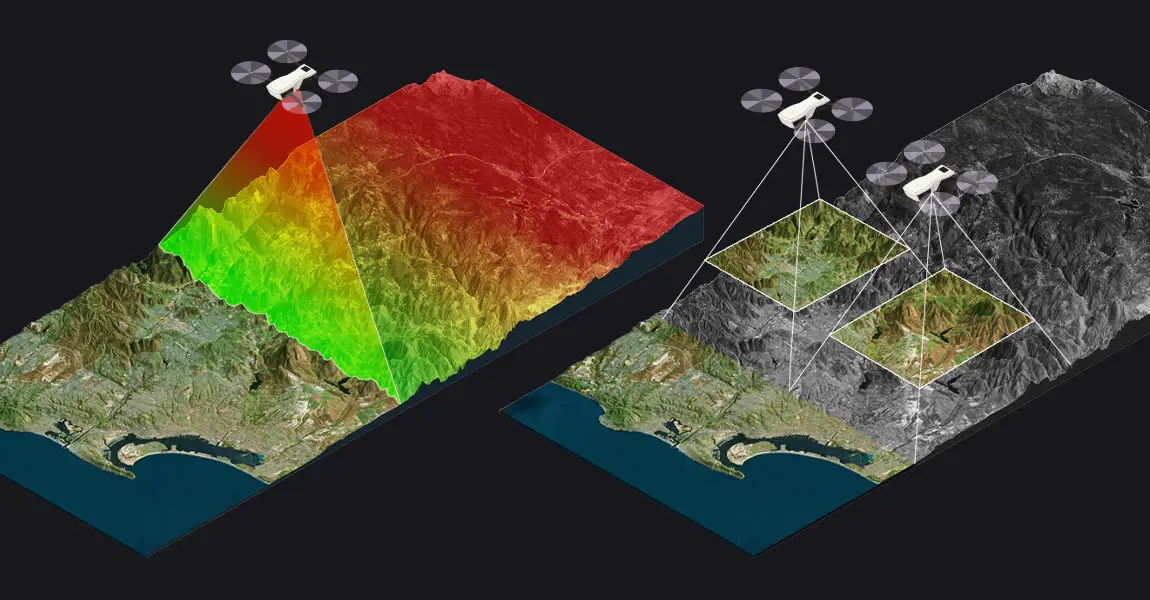
Rest API for Metashape photogrammetry controller, it allows to process drone images and calculate volumes, sections, cross-sections from it.

Rest API for Metashape photogrammetry controller, it allows to process drone images and calculate volumes, sections, cross-sections from it.
Field notes from the workbench — geomatics, software, and the occasional rabbit hole.
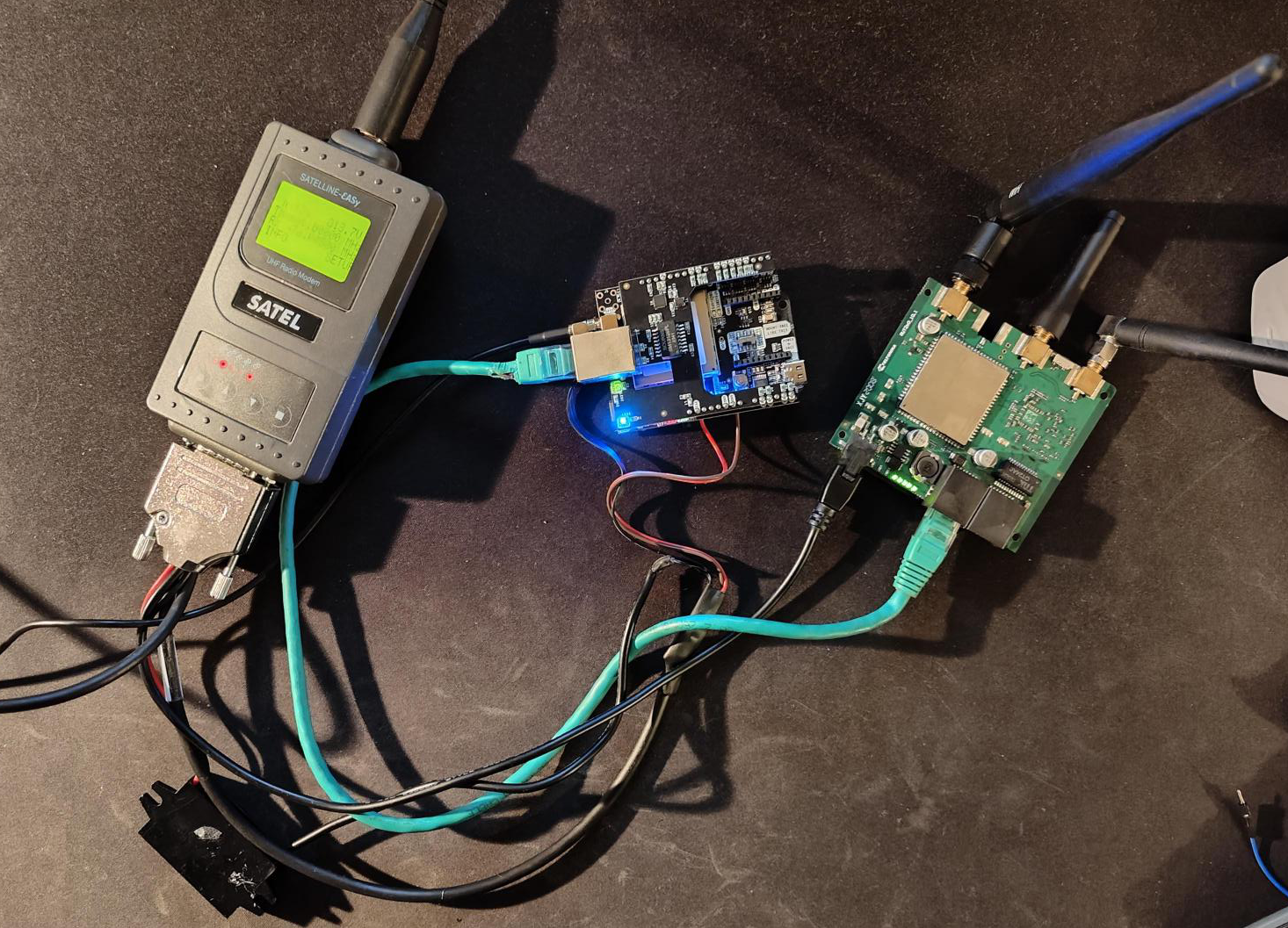
Create Static CORS for your constructions sites
READ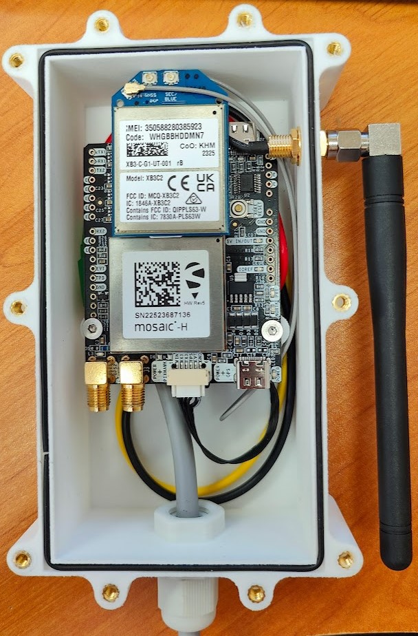
Create RTK rover box for your constructions sites
READ